Geolocate

Tarkarli topographic map

Click on the map to display elevation.

About this map

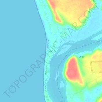
Name: Tarkarli topographic map, elevation, terrain.

Location: Tarkarli, Malwan, Sindhudurg, Maharashtra, 416523, India (15.98681 73.47184 16.02681 73.51184)

Average elevation: 39 ft

Minimum elevation: -3 ft

Maximum elevation: 230 ft

Gear up for your next adventure:

🧭Pro Hiking Compasses - High-accuracy liquid-filled compasses for topographic orientation
📷Action Camera - Capture your outdoor adventures in HD
🦺Reflective Outdoor Gear - Safety gear for low‑light conditions
🪶Trail Camera - Capture wildlife on your hikes
🎒Waterproof Dry Bags - Keep your electronics and maps dry inside your pack

As an Amazon Associate, this site earns from qualifying purchases at no extra cost to you.