Geolocate

Selkirk topographic map

Click on the map to display elevation.

About this map

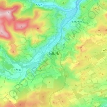
Name: Selkirk topographic map, elevation, terrain.

Location: Selkirk, Scottish Borders, Scotland, TD7 4BT, United Kingdom (55.50707 -2.88154 55.58707 -2.80154)

Average elevation: 741 ft

Minimum elevation: 318 ft

Maximum elevation: 1,496 ft

Gear up for your next adventure:

Backpacking Tents - Weight-optimized shelters for multi-day topographic surveys
🧭GPS Watch Accessories - Bands and chargers for GPS watches
🧦Hiking Socks - Comfortable socks to prevent blisters on long hikes
🌎3D Topographic Globes - Raised relief globes for a tactile understanding of geography
📦Dry Bags Set - Waterproof storage for electronics and clothes

As an Amazon Associate, this site earns from qualifying purchases at no extra cost to you.