
Make a donation
Gear up for your next adventure:
As an Amazon Associate, this site earns from qualifying purchases at no extra cost to you.
Frondarola topographic map
Click on the map to display elevation.
Make a donation
Gear up for your next adventure:
As an Amazon Associate, this site earns from qualifying purchases at no extra cost to you.
Frondarola
Frondarola è una frazione del comune di Teramo, sita a 6 km dal capoluogo, a un'altitudine di 483 m s.l.m.; ha circa 600 abitanti.
Make a donation
Gear up for your next adventure:
As an Amazon Associate, this site earns from qualifying purchases at no extra cost to you.
About this map
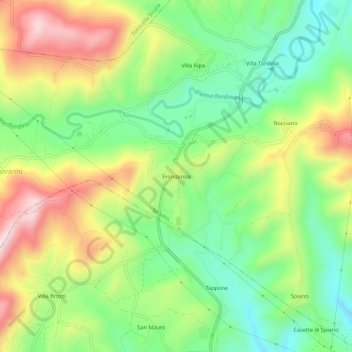
Name: Frondarola topographic map, elevation, terrain.
Location: Frondarola, Teramo, Abruzzo, 64046, Italia (42.60098 13.62850 42.64098 13.66850)
Average elevation: 1,345 ft
Minimum elevation: 794 ft
Maximum elevation: 2,129 ft
Make a donation
Gear up for your next adventure:
As an Amazon Associate, this site earns from qualifying purchases at no extra cost to you.
Other topographic maps
Click on a map to view its topography, its elevation and its terrain.