
Camp Verde topographic map
Interactive map
Click on the map to display elevation.
About this map
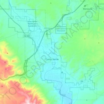
Name: Camp Verde topographic map, elevation, terrain.
Location: Camp Verde, Yavapai County, Arizona, 86322, United States (34.49771 -111.96510 34.65280 -111.76069)
Average elevation: 3,593 ft
Minimum elevation: 2,986 ft
Maximum elevation: 6,007 ft
Arizona trails, hiking, mountain biking, running and outdoor activities