
Thank you for supporting this site ❤️
Make a donation
Make a donation
Gear up for your next adventure:
As an Amazon Associate, this site earns from qualifying purchases at no extra cost to you.
Salvia topographic map
Click on the map to display elevation.
Thank you for supporting this site ❤️
Make a donation
Make a donation
Gear up for your next adventure:
As an Amazon Associate, this site earns from qualifying purchases at no extra cost to you.
About this map
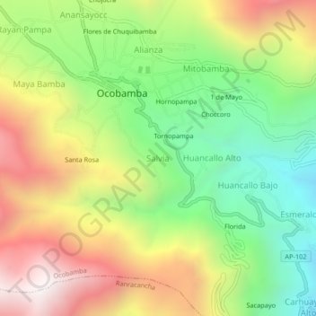
Name: Salvia topographic map, elevation, terrain.
Location: Salvia, Ocobamba, Chincheros, Apurímac, Perú (-13.51080 -73.57573 -13.47080 -73.53573)
Average elevation: 10,364 ft
Minimum elevation: 8,363 ft
Maximum elevation: 12,831 ft
Thank you for supporting this site ❤️
Make a donation
Make a donation
Gear up for your next adventure:
As an Amazon Associate, this site earns from qualifying purchases at no extra cost to you.