
Thank you for supporting this site ❤️
Make a donation
Make a donation
Gear up for your next adventure:
As an Amazon Associate, this site earns from qualifying purchases at no extra cost to you.
Panchorra topographic map
Click on the map to display elevation.
Thank you for supporting this site ❤️
Make a donation
Make a donation
Gear up for your next adventure:
As an Amazon Associate, this site earns from qualifying purchases at no extra cost to you.
About this map
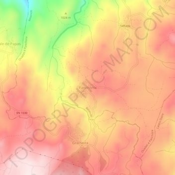
Name: Panchorra topographic map, elevation, terrain.
Location: Panchorra, Ovadas e Panchora, Resende, Viseu, Portugal (40.99543 -7.98718 41.03543 -7.94718)
Average elevation: 3,570 ft
Minimum elevation: 2,592 ft
Maximum elevation: 4,075 ft
Thank you for supporting this site ❤️
Make a donation
Make a donation
Gear up for your next adventure:
As an Amazon Associate, this site earns from qualifying purchases at no extra cost to you.