
Green Bay topographic map
Click on the map to display elevation.
About this map
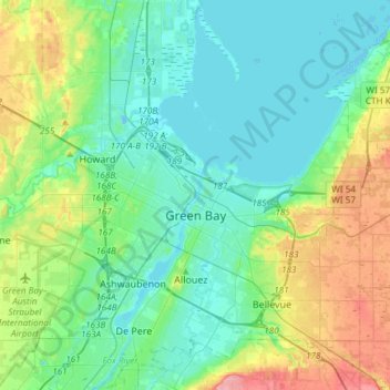
Name: Green Bay topographic map, elevation, terrain.
Location: Green Bay, Brown County, Wisconsin, United States (44.47179 -88.13982 44.57469 -87.84117)
Average elevation: 653 ft
Minimum elevation: 574 ft
Maximum elevation: 886 ft
Brown County trails, hiking, mountain biking, running and outdoor activities
Other topographic maps
Click on a map to view its topography, its elevation and its terrain.