
Thank you for supporting this site ❤️
Make a donation
Make a donation
Gear up for your next adventure:
As an Amazon Associate, this site earns from qualifying purchases at no extra cost to you.
Guaytacama topographic map
Click on the map to display elevation.
Thank you for supporting this site ❤️
Make a donation
Make a donation
Gear up for your next adventure:
As an Amazon Associate, this site earns from qualifying purchases at no extra cost to you.
About this map
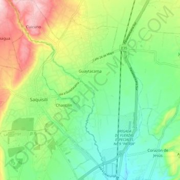
Name: Guaytacama topographic map, elevation, terrain.
Location: Guaytacama, Latacunga, Cotopaxi, 050109, Ecuador (-0.87766 -78.68048 -0.79065 -78.61602)
Average elevation: 9,596 ft
Minimum elevation: 9,242 ft
Maximum elevation: 10,233 ft
Thank you for supporting this site ❤️
Make a donation
Make a donation
Gear up for your next adventure:
As an Amazon Associate, this site earns from qualifying purchases at no extra cost to you.