
Make a donation
Gear up for your next adventure:
As an Amazon Associate, this site earns from qualifying purchases at no extra cost to you.
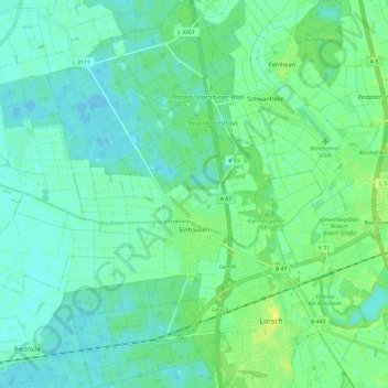
Einhausen topographic map
Click on the map to display elevation.
Make a donation
Gear up for your next adventure:
As an Amazon Associate, this site earns from qualifying purchases at no extra cost to you.
Einhausen
Die Statistisch-topographisch-historische Beschreibung des Großherzogthums Hessen schreibt 1829 über
Make a donation
Gear up for your next adventure:
As an Amazon Associate, this site earns from qualifying purchases at no extra cost to you.
About this map
Name: Einhausen topographic map, elevation, terrain.
Location: Einhausen, Bergstraße, Hessen, 64683, Deutschland (49.64150 8.47861 49.71738 8.56939)
Average elevation: 308 ft
Minimum elevation: 289 ft
Maximum elevation: 341 ft
Make a donation
Gear up for your next adventure:
As an Amazon Associate, this site earns from qualifying purchases at no extra cost to you.
Other topographic maps
Click on a map to view its topography, its elevation and its terrain.
Schloss Auerbach
Deutschland > Hessen > Bergstraße > Auerbach
Auf einer Schildmauer der Burganlage steht eine über 300-jährige, etwa sieben Meter hohe Waldkiefer. Die anspruchslose Pflanze wurzelt in luftiger Höhe auf dem Bauwerk und deckt einen Teil ihres Wasserbedarfs über die Luftfeuchte, die an den Nadeln kondensiert und zu Boden tropft. Aufgrund der sehr kargen…
Average elevation: 669 ft