
Mapleton National Park topographic map
Interactive map
Click on the map to display elevation.
About this map
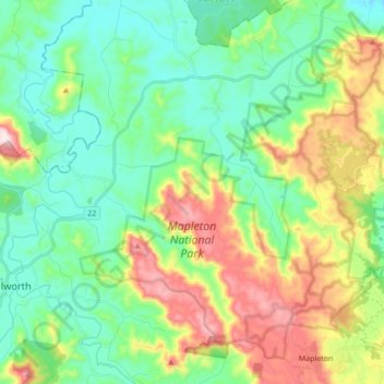
Name: Mapleton National Park topographic map, elevation, terrain.
Average elevation: 656 ft
Minimum elevation: 180 ft
Maximum elevation: 1,703 ft
Other topographic maps
Click on a map to view its topography, its elevation and its terrain.
Gheerulla
Australia > Queensland > Gheerulla
Gheerulla, Queensland, Australia
Average elevation: 377 ft
Coolabine
Australia > Queensland > Maroochydore > Gheerulla
Coolabine, Maroochydore, Queensland, Australia
Average elevation: 791 ft