
Gheerulla topographic map
Interactive map
Click on the map to display elevation.
About this map
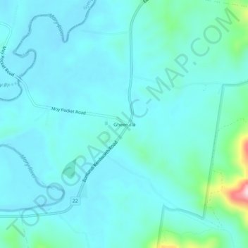
Name: Gheerulla topographic map, elevation, terrain.
Location: Gheerulla, Queensland, Australia (-26.57378 152.75471 -26.53378 152.79471)
Average elevation: 377 ft
Minimum elevation: 249 ft
Maximum elevation: 1,207 ft
Other topographic maps
Click on a map to view its topography, its elevation and its terrain.
Mapleton National Park
Australia > Queensland > Gheerulla
Mapleton National Park, Great Walk, Gheerulla, Queensland, Australia
Average elevation: 656 ft
Coolabine
Australia > Queensland > Maroochydore > Gheerulla
Coolabine, Maroochydore, Queensland, Australia
Average elevation: 791 ft