
Thank you for supporting this site ❤️
Make a donation
Make a donation
Gear up for your next adventure:
As an Amazon Associate, this site earns from qualifying purchases at no extra cost to you.
Rottstock topographic map
Click on the map to display elevation.
Thank you for supporting this site ❤️
Make a donation
Make a donation
Gear up for your next adventure:
As an Amazon Associate, this site earns from qualifying purchases at no extra cost to you.
About this map
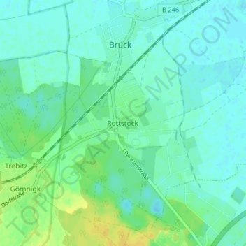
Name: Rottstock topographic map, elevation, terrain.
Location: Rottstock, Brück, Potsdam-Mittelmark, Brandenburg, Deutschland (52.15952 12.73908 52.19952 12.77908)
Average elevation: 161 ft
Minimum elevation: 141 ft
Maximum elevation: 210 ft
Thank you for supporting this site ❤️
Make a donation
Make a donation
Gear up for your next adventure:
As an Amazon Associate, this site earns from qualifying purchases at no extra cost to you.