
Thank you for supporting this site ❤️
Make a donation
Make a donation
Gear up for your next adventure:
As an Amazon Associate, this site earns from qualifying purchases at no extra cost to you.
Nansadi topographic map
Click on the map to display elevation.
Thank you for supporting this site ❤️
Make a donation
Make a donation
Gear up for your next adventure:
As an Amazon Associate, this site earns from qualifying purchases at no extra cost to you.
About this map
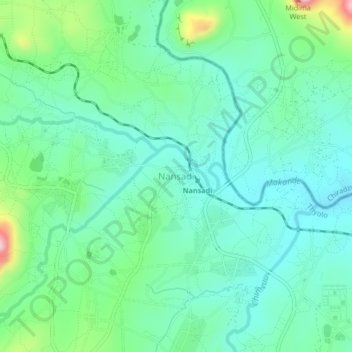
Name: Nansadi topographic map, elevation, terrain.
Location: Nansadi, Thyolo, Southern Region, Malawi, Malawi (-15.90758 35.17820 -15.86758 35.21820)
Average elevation: 2,736 ft
Minimum elevation: 2,530 ft
Maximum elevation: 3,379 ft
Thank you for supporting this site ❤️
Make a donation
Make a donation
Gear up for your next adventure:
As an Amazon Associate, this site earns from qualifying purchases at no extra cost to you.