
Thank you for supporting this site ❤️
Make a donation
Make a donation
Gear up for your next adventure:
As an Amazon Associate, this site earns from qualifying purchases at no extra cost to you.
Acquasanta topographic map
Click on the map to display elevation.
Thank you for supporting this site ❤️
Make a donation
Make a donation
Gear up for your next adventure:
As an Amazon Associate, this site earns from qualifying purchases at no extra cost to you.
About this map
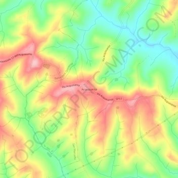
Name: Acquasanta topographic map, elevation, terrain.
Location: Acquasanta, San Marcello, Ancona, Marche, 60030, Italia (43.52020 13.15766 43.56020 13.19766)
Average elevation: 505 ft
Minimum elevation: 262 ft
Maximum elevation: 758 ft
Thank you for supporting this site ❤️
Make a donation
Make a donation
Gear up for your next adventure:
As an Amazon Associate, this site earns from qualifying purchases at no extra cost to you.