
Rorschacherberg topographic map
Interactive map
Click on the map to display elevation.
About this map
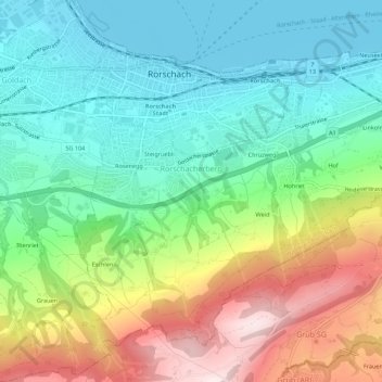
Name: Rorschacherberg topographic map, elevation, terrain.
Location: Rorschacherberg, Wahlkreis Rorschach, St. Gallen, 9404, Schweiz (47.45137 9.47775 47.48165 9.53287)
Average elevation: 1,923 ft
Minimum elevation: 1,286 ft
Maximum elevation: 3,150 ft