
Thank you for supporting this site ❤️
Make a donation
Make a donation
Gear up for your next adventure:
As an Amazon Associate, this site earns from qualifying purchases at no extra cost to you.
Chikkodi topographic map
Click on the map to display elevation.
Thank you for supporting this site ❤️
Make a donation
Make a donation
Gear up for your next adventure:
As an Amazon Associate, this site earns from qualifying purchases at no extra cost to you.
About this map
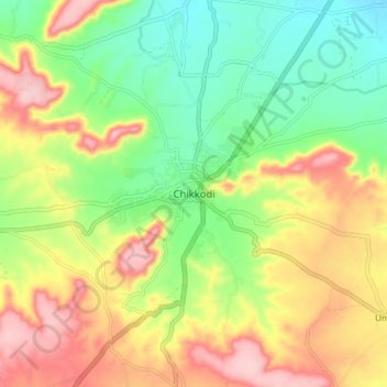
Name: Chikkodi topographic map, elevation, terrain.
Location: Chikkodi, Chikodi taluk, Belagavi, Karnataka, 591200, India (16.38653 74.54613 16.46653 74.62613)
Average elevation: 2,201 ft
Minimum elevation: 1,919 ft
Maximum elevation: 2,549 ft
Thank you for supporting this site ❤️
Make a donation
Make a donation
Gear up for your next adventure:
As an Amazon Associate, this site earns from qualifying purchases at no extra cost to you.