Geolocate

Gajah topographic map

Click on the map to display elevation.

About this map

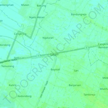
Name: Gajah topographic map, elevation, terrain.

Location: Gajah, Demak, Central Java, Java, 59581, Indonesia (-6.91094 110.69312 -6.83094 110.77312)

Average elevation: 20 ft

Minimum elevation: 7 ft

Maximum elevation: 33 ft

Other topographic maps

Click on a map to view its topography, its elevation and its terrain.

Bonang

Indonesia > Central Java > Demak

Average elevation: 10 ft

Wedung

Indonesia > Central Java > Demak

Average elevation: 10 ft

Gear up for your next adventure:

🧭Compass with Lanyard - Easy‑carry compass for navigation
🔦Powerful Headlamps - Ultra-bright hands-free lighting for night navigation
🔌Solar Panel Charger - Charge gear sustainably outdoors
🩳Quick‑Dry Hiking Shorts - Comfortable and quick‑dry shorts for summer hiking
🧣Hiking Neck Gaiter - Multi‑use neck protection for outdoor weather

As an Amazon Associate, this site earns from qualifying purchases at no extra cost to you.