Geolocate

Defiance topographic map

Click on the map to display elevation.

About this map

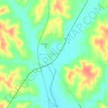
Name: Defiance topographic map, elevation, terrain.

Location: Defiance, Shelby County, Iowa, 51527, United States (41.80409 -95.36135 41.84409 -95.32135)

Average elevation: 1,316 ft

Minimum elevation: 1,247 ft

Maximum elevation: 1,421 ft

Gear up for your next adventure:

🔭Telescopic Hiking Pole - Adjustable pole for hiking stability
🖼️Topo Map Wall Art - Decorative topographic prints of famous peaks and regions
🛠️Outdoor Gear Repair Kit - Essential tools to fix gear on the trail
🧼Biodegradable Camping Soap - Eco‑friendly soap for outdoor hygiene
🎒Outdoor Daypacks - Lightweight backpacks designed for carrying maps and essential gear

As an Amazon Associate, this site earns from qualifying purchases at no extra cost to you.