

Dir topographic map
Click on the map to display elevation.
Dir
The topography of Upper Dir is dominated by high mountains. The most important mountain range is the Hindu Kush. It runs from north east to south west along the northern borders with Chitral District. In winter whole area remains snow-covered. The mountains in the western part of the district are covered with forests, while the eastern mountain range, Dir Kohistan is barren. Panjkora River is the main river of the district, which originates from Dir Kohistan. Upper Dir headquarters is connected to all tehsil headquarters.
About this map
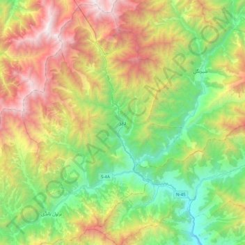
Name: Dir topographic map, elevation, terrain.
Average elevation: 7,231 ft
Minimum elevation: 3,340 ft
Maximum elevation: 13,996 ft
Other topographic maps
Click on a map to view its topography, its elevation and its terrain.
