
Thank you for supporting this site ❤️
Make a donation
Make a donation
Gear up for your next adventure:
As an Amazon Associate, this site earns from qualifying purchases at no extra cost to you.
Milinguana topographic map
Click on the map to display elevation.
Thank you for supporting this site ❤️
Make a donation
Make a donation
Gear up for your next adventure:
As an Amazon Associate, this site earns from qualifying purchases at no extra cost to you.
About this map
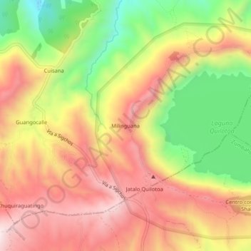
Name: Milinguana topographic map, elevation, terrain.
Location: Milinguana, Chugchillan, Sigchos, Cotopaxi, 050456, Ecuador (-0.87903 -78.93965 -0.83903 -78.89965)
Average elevation: 12,064 ft
Minimum elevation: 10,915 ft
Maximum elevation: 12,995 ft
Thank you for supporting this site ❤️
Make a donation
Make a donation
Gear up for your next adventure:
As an Amazon Associate, this site earns from qualifying purchases at no extra cost to you.
Other topographic maps
Click on a map to view its topography, its elevation and its terrain.