Geolocate

Palmview topographic map

Click on the map to display elevation.

About this map

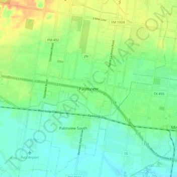
Name: Palmview topographic map, elevation, terrain.

Location: Palmview, Hidalgo County, Texas, 78572, United States (26.19341 -98.41085 26.27341 -98.33085)

Average elevation: 148 ft

Minimum elevation: 102 ft

Maximum elevation: 230 ft

Hidalgo County trails, hiking, mountain biking, running and outdoor activities

Gear up for your next adventure:

🔊Portable Camp Speaker - Music and alerts at camp
🛡️Insect Repellent - Protection against bugs during outdoor activities
🪄Magnetic Compass - Accurate compass for navigation
🛰️Handheld GPS Units - Professional satellite navigators for precise backcountry mapping
🏔️Mountain Trail Maps - High‑detail maps for popular peaks

As an Amazon Associate, this site earns from qualifying purchases at no extra cost to you.