Geolocate

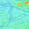
Station Front topographic map

Click on the map to display elevation.

About this map

Name: Station Front topographic map, elevation, terrain.

Location: Station Front, Taipei, 10018, Taiwan (25.02643 121.49528 25.06643 121.53528)

Average elevation: 39 ft

Minimum elevation: -3 ft

Maximum elevation: 118 ft

Other topographic maps

Click on a map to view its topography, its elevation and its terrain.

Da'an District

Taiwan > Taipei

Average elevation: 59 ft

Songshan District

Taiwan > Taipei

Average elevation: 43 ft

Beitou

Taiwan > Taipei > Qiyan

Average elevation: 853 ft

Island

Taiwan > Taipei > Qiyan

Average elevation: 98 ft

Gear up for your next adventure:

⛑️Personal Locator Beacon - Safety beacon for emergencies
🥾Women's Hiking Boots - Top-rated trail boots with ankle support and superior grip
🧣Hiking Neck Gaiter - Multi‑use neck protection for outdoor weather
🔋Solar Power Banks - Keep your GPS and phone charged in remote wilderness areas
🗺️Topographic Maps - Detailed topo maps for hiking, exploring and outdoor navigation

As an Amazon Associate, this site earns from qualifying purchases at no extra cost to you.