Geolocate

Tinoto topographic map

Click on the map to display elevation.

About this map

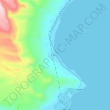
Name: Tinoto topographic map, elevation, terrain.

Location: Tinoto, Maasim, Sarangani, Soccsksargen, 9502, Philippines (5.88227 125.05963 5.92227 125.09963)

Average elevation: 328 ft

Minimum elevation: -3 ft

Maximum elevation: 1,289 ft

Gear up for your next adventure:

🔥Plasma Lighters - Windproof lighters that work in any weather condition
📱Solar Portable Charger - Solar power bank for charging devices off‑grid
🌧️Backpack Rain Cover - Keep gear dry in wet weather
📻Weather Alert Radios - Stay informed of storm risks while off-the-grid
🔥Fast-Boil Camping Stoves - Efficient cooking systems for quick trail meals

As an Amazon Associate, this site earns from qualifying purchases at no extra cost to you.