Geolocate

Goodwood topographic map

Click on the map to display elevation.

About this map

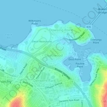
Name: Goodwood topographic map, elevation, terrain.

Location: Goodwood, Hobart, City of Glenorchy, Tasmania, Australia (-42.83047 147.28545 -42.82326 147.30087)

Average elevation: 33 ft

Minimum elevation: -7 ft

Maximum elevation: 240 ft

Other topographic maps

Click on a map to view its topography, its elevation and its terrain.

Waterworks Reserve

Australia > Tasmania > Hobart

Average elevation: 787 ft

Gear up for your next adventure:

📚Navigation Handbooks - Master the art of reading topographic maps and using a compass
📷Action Camera - Capture your outdoor adventures in HD
🪵Folding Camp Saw - Compact saw for wood and campsite work
🪶Fire Starter Kit - Reliable fire starter for survival and camping
🗺️NatGeo Topo Maps - High-quality waterproof printed topographic maps of US Parks

As an Amazon Associate, this site earns from qualifying purchases at no extra cost to you.