
Thank you for supporting this site ❤️
Make a donation
Make a donation
Gear up for your next adventure:
As an Amazon Associate, this site earns from qualifying purchases at no extra cost to you.
Brodswinden topographic map
Click on the map to display elevation.
Thank you for supporting this site ❤️
Make a donation
Make a donation
Gear up for your next adventure:
As an Amazon Associate, this site earns from qualifying purchases at no extra cost to you.
About this map
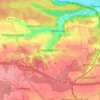
Name: Brodswinden topographic map, elevation, terrain.
Location: Brodswinden, Ansbach, Bayern, 91595, Deutschland (49.24353 10.58625 49.28353 10.62625)
Average elevation: 1,499 ft
Minimum elevation: 1,289 ft
Maximum elevation: 1,601 ft
Thank you for supporting this site ❤️
Make a donation
Make a donation
Gear up for your next adventure:
As an Amazon Associate, this site earns from qualifying purchases at no extra cost to you.