Geolocate

Jaro topographic map

Click on the map to display elevation.

About this map

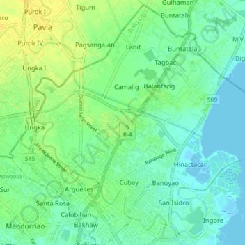
Name: Jaro topographic map, elevation, terrain.

Location: Jaro, Iloilo City, Iloilo, Western Visayas, Philippines (10.71244 122.53536 10.78245 122.60267)

Average elevation: 26 ft

Minimum elevation: -7 ft

Maximum elevation: 69 ft

Gear up for your next adventure:

📦Dry Bags Set - Waterproof storage for electronics and clothes
🩹Survival Bandages - High‑quality bandages for emergencies
🧭Pro Hiking Compasses - High-accuracy liquid-filled compasses for topographic orientation
🪶Trail Camera - Capture wildlife on your hikes
🧺Microfiber Travel Towels - Compact and fast-drying towels for trail use

As an Amazon Associate, this site earns from qualifying purchases at no extra cost to you.