Geolocate

Rowe topographic map

Click on the map to display elevation.

About this map

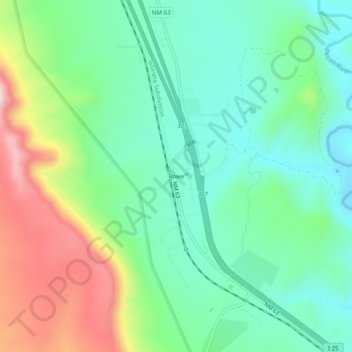
Name: Rowe topographic map, elevation, terrain.

Location: Rowe, San Miguel County, New Mexico, 87562, United States (35.47165 -105.69529 35.51165 -105.65529)

Average elevation: 7,018 ft

Minimum elevation: 6,604 ft

Maximum elevation: 7,897 ft

San Miguel County trails, hiking, mountain biking, running and outdoor activities

Gear up for your next adventure:

🏔️Mountain Trail Maps - High‑detail maps for popular peaks
🎒Waterproof Dry Bags - Keep your electronics and maps dry inside your pack
🪶Wildlife Field Guides - Learn animal tracking and species ID
🧯Emergency Survival Kit - All‑in‑one survival essentials for the backcountry
🧭Hiking Compass - Precision compass for reliable navigation in the wilderness

As an Amazon Associate, this site earns from qualifying purchases at no extra cost to you.