
Thank you for supporting this site ❤️
Make a donation
Make a donation
Gear up for your next adventure:
As an Amazon Associate, this site earns from qualifying purchases at no extra cost to you.
Halmstad topographic map
Click on the map to display elevation.
Thank you for supporting this site ❤️
Make a donation
Make a donation
Gear up for your next adventure:
As an Amazon Associate, this site earns from qualifying purchases at no extra cost to you.
About this map
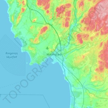
Name: Halmstad topographic map, elevation, terrain.
Location: Halmstad, Halmstads kommun, Halland County, 302 42, Sweden (56.51398 12.69748 56.83398 13.01748)
Average elevation: 125 ft
Minimum elevation: -7 ft
Maximum elevation: 676 ft
Thank you for supporting this site ❤️
Make a donation
Make a donation
Gear up for your next adventure:
As an Amazon Associate, this site earns from qualifying purchases at no extra cost to you.