Geolocate

Topsham topographic map

Click on the map to display elevation.

About this map

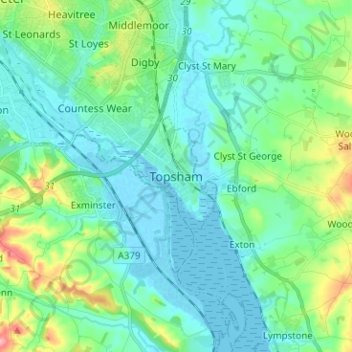
Name: Topsham topographic map, elevation, terrain.

Location: Topsham, Exeter, Devon, England, EX3 0DT, United Kingdom (50.64507 -3.50581 50.72507 -3.42581)

Average elevation: 82 ft

Minimum elevation: -10 ft

Maximum elevation: 384 ft

Gear up for your next adventure:

🔥Plasma Lighters - Windproof lighters that work in any weather condition
Backpacking Tents - Weight-optimized shelters for multi-day topographic surveys
🛰️Handheld GPS Units - Professional satellite navigators for precise backcountry mapping
🥩Freeze-Dried Meals - Nutritious and lightweight food for remote expeditions
🌎3D Topographic Globes - Raised relief globes for a tactile understanding of geography

As an Amazon Associate, this site earns from qualifying purchases at no extra cost to you.