
Thank you for supporting this site ❤️
Make a donation
Make a donation
Gear up for your next adventure:
As an Amazon Associate, this site earns from qualifying purchases at no extra cost to you.
Arenal topographic map
Click on the map to display elevation.
Thank you for supporting this site ❤️
Make a donation
Make a donation
Gear up for your next adventure:
As an Amazon Associate, this site earns from qualifying purchases at no extra cost to you.
About this map
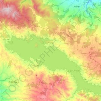
Name: Arenal topographic map, elevation, terrain.
Location: Arenal, Cantón de Tilarán, Guanacaste, 50807, Costa Rica (10.45999 -84.96444 10.59874 -84.77327)
Average elevation: 2,139 ft
Minimum elevation: 545 ft
Maximum elevation: 3,970 ft
Thank you for supporting this site ❤️
Make a donation
Make a donation
Gear up for your next adventure:
As an Amazon Associate, this site earns from qualifying purchases at no extra cost to you.