Geolocate

広名田 topographic map

Click on the map to display elevation.

About this map

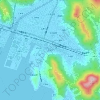
Name: 広名田 topographic map, elevation, terrain.

Location: 広名田, Kure, Hiroshima Prefecture, 737-0125, Japan (34.20664 132.60537 34.24664 132.64537)

Average elevation: 177 ft

Minimum elevation: -13 ft

Maximum elevation: 1,138 ft

Gear up for your next adventure:

🪶Compact Camp Shovel - Folding shovel for campsite tasks
📚USA Hiking Guide Books - Top trail guides and map books
📷Action Camera - Capture your outdoor adventures in HD
🧭Orienteering Set - Complete compass and map reading kit
🪶Paracord Bracelet - Survival bracelet with built‑in tools

As an Amazon Associate, this site earns from qualifying purchases at no extra cost to you.