
Parsan topographic map
Click on the map to display elevation.
About this map
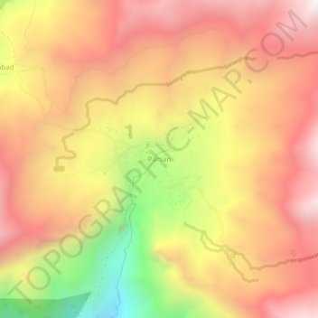
Name: Parsan topographic map, elevation, terrain.
Average elevation: 9,980 ft
Minimum elevation: 7,290 ft
Maximum elevation: 11,755 ft
Other topographic maps
Click on a map to view its topography, its elevation and its terrain.
Dir Gol
Pakistan > Khyber Pakhtunkhwa > Chitrāl District > Chitral Tehsil
Average elevation: 12,267 ft
Upper Gazikistan Glacier
Pakistan > Khyber Pakhtunkhwa > Chitrāl District > Chitral Tehsil
Average elevation: 16,686 ft
Bamburait River
Pakistan > Khyber Pakhtunkhwa > Chitrāl District > Chitral Tehsil
Average elevation: 9,839 ft