Geolocate

Liberty topographic map

Click on the map to display elevation.

About this map
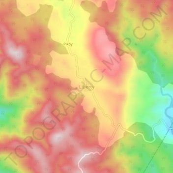
Name: Liberty topographic map, elevation, terrain.

Location: Liberty, Ormoc, 4th District, Leyte, Eastern Visayas, 6541, Philippines (10.95734 124.72942 10.99734 124.76942)

Average elevation: 1,965 ft

Minimum elevation: 988 ft

Maximum elevation: 2,569 ft

Other topographic maps

Click on a map to view its topography, its elevation and its terrain.

Binahaan River

Philippines > Leyte > Ormoc

Average elevation: 1,791 ft

Binahaan River

Philippines > Leyte > Ormoc

Average elevation: 1,624 ft

Ormoc City Proper

Philippines > Leyte > Ormoc

Average elevation: 59 ft

Gear up for your next adventure:

🧢Sun Protection Hats - Wide-brimmed and UPF-rated hats for high-altitude sun safety
🧢Outdoor Hiking Hat - Sun protection hat for outdoor explorers
🧭Pro Hiking Compasses - High-accuracy liquid-filled compasses for topographic orientation
💧Water Purification System - Clean water on the trail with reliable purifiers
⌚Solar GPS Watches - Advanced multisport watches with built-in topographic maps

As an Amazon Associate, this site earns from qualifying purchases at no extra cost to you.