Geolocate

Erode topographic map

Click on the map to display elevation.

About this map

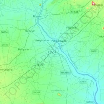
Name: Erode topographic map, elevation, terrain.

Location: Erode, Tamil Nadu, 638001, India (11.17065 77.56765 11.49065 77.88765)

Average elevation: 686 ft

Minimum elevation: 420 ft

Maximum elevation: 2,287 ft

Gear up for your next adventure:

🔥Fast-Boil Camping Stoves - Efficient cooking systems for quick trail meals
🌎3D Topographic Globes - Raised relief globes for a tactile understanding of geography
🛠️Backpacking Tool Kit - Essential toolkit for outdoor repairs
🛠️Outdoor Gear Repair Kit - Essential tools to fix gear on the trail
🧥Men's Rain Shells - Premium waterproof and breathable jackets for mountain weather

As an Amazon Associate, this site earns from qualifying purchases at no extra cost to you.