
Mahasamund topographic map
Click on the map to display elevation.
Mahasamund
Mahasamund is located at 21°06′N 82°06′E / 21.1°N 82.1°E / 21.1; 82.1. It has an average elevation of 318 metres (1043 feet). Mahasamund is 56 kilometres south-east of Raipur on the junction of National Highway 6 and National Highway 217 close to the Mahanadi River. Mahasamund city is an important station on the Raipur-Vizag rail route. Mahasamund and Raipur are the only district headquarter cities which are close to the state capital of Chhattisgarh, Naya Raipur.
About this map
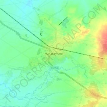
Name: Mahasamund topographic map, elevation, terrain.
Average elevation: 955 ft
Minimum elevation: 899 ft
Maximum elevation: 1,066 ft