Geolocate

Banyurojo topographic map

Click on the map to display elevation.

About this map

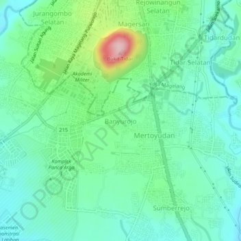
Name: Banyurojo topographic map, elevation, terrain.

Location: Banyurojo, Magelang, Central Java, Java, 56124, Indonesia (-7.52838 110.19850 -7.48838 110.23850)

Average elevation: 1,135 ft

Minimum elevation: 968 ft

Maximum elevation: 1,627 ft

Other topographic maps

Click on a map to view its topography, its elevation and its terrain.

Salam

Indonesia > Central Java > Magelang

Average elevation: 932 ft

Adikarto

Indonesia > Central Java > Magelang > Tanjung

Average elevation: 804 ft

Sungai Progo

Indonesia > Central Java > Magelang > Mungkid

Average elevation: 761 ft

Dukun

Indonesia > Central Java > Magelang

Average elevation: 2,989 ft

Ngluwar

Indonesia > Central Java > Magelang

Average elevation: 794 ft

Srumbung

Indonesia > Central Java > Magelang

Average elevation: 2,507 ft

Sawangan

Indonesia > Central Java > Magelang

Average elevation: 4,262 ft

Muntilan

Indonesia > Central Java > Magelang

Average elevation: 971 ft

Gear up for your next adventure:

🌐World Map Poster - Decorative world maps with topographic info
🚑Emergency Bivvies - Heat-reflective sleeping bags for survival situations
🛠️Backpacking Tool Kit - Essential toolkit for outdoor repairs
🗺️NatGeo Topo Maps - High-quality waterproof printed topographic maps of US Parks
🗻Climbing Gear Basics - Essential gear for beginner climbers

As an Amazon Associate, this site earns from qualifying purchases at no extra cost to you.