
Brightwater topographic map
Click on the map to display elevation.
About this map
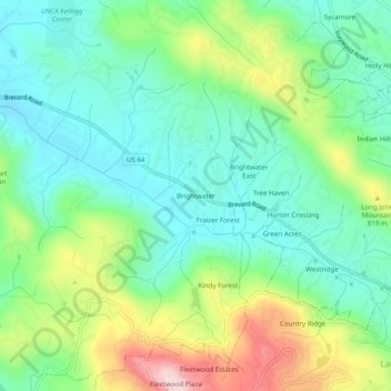
Name: Brightwater topographic map, elevation, terrain.
Average elevation: 2,388 ft
Minimum elevation: 2,051 ft
Maximum elevation: 3,120 ft
Henderson County trails, hiking, mountain biking, running and outdoor activities
Other topographic maps
Click on a map to view its topography, its elevation and its terrain.
Kanuga Lake
United States > North Carolina > Henderson County > Kanuga Ridge
Average elevation: 2,356 ft
Mills River
United States > North Carolina > Henderson County > Mills River > Oak Hill Court
Average elevation: 2,077 ft
Echo Lake
United States > North Carolina > Henderson County > Laurel Park > Country Ridge
Average elevation: 2,493 ft
Mills River
United States > North Carolina > Henderson County > Mills River
Average elevation: 2,251 ft
Mills River
United States > North Carolina > Henderson County > Mills River > Oak Hill Court
Average elevation: 2,113 ft
Barker Heights
United States > North Carolina > Henderson County > Barker Heights
Average elevation: 2,110 ft