
Make a donation
Gear up for your next adventure:
As an Amazon Associate, this site earns from qualifying purchases at no extra cost to you.
Bockum topographic map
Click on the map to display elevation.
Make a donation
Gear up for your next adventure:
As an Amazon Associate, this site earns from qualifying purchases at no extra cost to you.
About this map
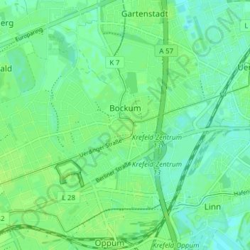
Name: Bockum topographic map, elevation, terrain.
Average elevation: 115 ft
Minimum elevation: 98 ft
Maximum elevation: 128 ft
Make a donation
Gear up for your next adventure:
As an Amazon Associate, this site earns from qualifying purchases at no extra cost to you.
Other topographic maps
Click on a map to view its topography, its elevation and its terrain.
Krefeld
Deutschland > Nordrhein-Westfalen > Krefeld
Krefeld liegt in der „Krefeld-Kempener Platte“, die Teil der Niederrheinischen Tiefebene ist. Das Stadtzentrum liegt etwa sieben Kilometer vom Rheinufer entfernt, doch reicht das Stadtgebiet seit der Eingemeindung Linns bis an den Rhein heran. Die Uferlänge auf Krefelder Gebiet beträgt 6,2 Kilometer (3,5…
Average elevation: 125 ft
Hülser Berg
Deutschland > Nordrhein-Westfalen > Krefeld
Der Hülser Berg entstand als Teil des Niederrheinischen Höhenzuges während des Drenthe-Vorstoßes der Saale-Eiszeit vor ca. 150.000 Jahren. Das aufgeschichtete Geröll, welches die Gletscher von Skandinavien kommend vor und unter sich her- und mitschoben, blieb nach Abtauen derselben in Form einer…
Average elevation: 115 ft