

Heusenstamm topographic map
Click on the map to display elevation.
Heusenstamm
Heusenstamm is one of 13 towns and communities in the Offenbach district. The town lies in the Frankfurt Rhine Main Region south of Frankfurt am Main and Offenbach am Main at an average elevation of 121 m above sea level. The town lies on the river Bieber. The lowest natural point is the Bieber's riverbed, and the highest is the Hoher Berg ("High Mountain"). Darmstadt, the seat of the Regierungsbezirk, is located to the southwest. Heusenstamm lies in the southern part of Hesse, not far from the Mittelgebirge of the Odenwald and Spessart.
About this map
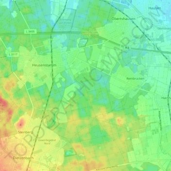
Name: Heusenstamm topographic map, elevation, terrain.
Location: Heusenstamm, Landkreis Offenbach, Hesse, 63150, Germany (50.02474 8.75557 50.06817 8.86325)
Average elevation: 423 ft
Minimum elevation: 364 ft
Maximum elevation: 518 ft