
Thank you for supporting this site ❤️
Make a donation
Make a donation
Gear up for your next adventure:
As an Amazon Associate, this site earns from qualifying purchases at no extra cost to you.
Sube y Baja topographic map
Click on the map to display elevation.
Thank you for supporting this site ❤️
Make a donation
Make a donation
Gear up for your next adventure:
As an Amazon Associate, this site earns from qualifying purchases at no extra cost to you.
About this map
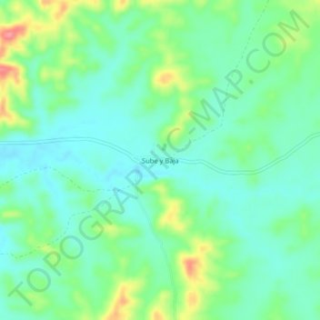
Name: Sube y Baja topographic map, elevation, terrain.
Location: Sube y Baja, Parroquia Simón Bolívar, Santa Elena, Ecuador (-2.21469 -80.46964 -2.17469 -80.42964)
Average elevation: 285 ft
Minimum elevation: 197 ft
Maximum elevation: 489 ft
Thank you for supporting this site ❤️
Make a donation
Make a donation
Gear up for your next adventure:
As an Amazon Associate, this site earns from qualifying purchases at no extra cost to you.