
Thank you for supporting this site ❤️
Make a donation
Make a donation
Gear up for your next adventure:
As an Amazon Associate, this site earns from qualifying purchases at no extra cost to you.
Timbío topographic map
Click on the map to display elevation.
Thank you for supporting this site ❤️
Make a donation
Make a donation
Gear up for your next adventure:
As an Amazon Associate, this site earns from qualifying purchases at no extra cost to you.
About this map
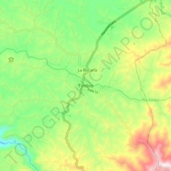
Name: Timbío topographic map, elevation, terrain.
Location: Timbío, Centro, Cauca, Pacífica, Colombia (2.31289 -76.72389 2.39289 -76.64389)
Average elevation: 5,997 ft
Minimum elevation: 5,187 ft
Maximum elevation: 7,257 ft
Thank you for supporting this site ❤️
Make a donation
Make a donation
Gear up for your next adventure:
As an Amazon Associate, this site earns from qualifying purchases at no extra cost to you.