
Monument topographic map
Click on the map to display elevation.
Monument
Monument is situated at an elevation of approximately 7,000 feet (2,134 meters) within the Front Range of the Rocky Mountains, creating a diverse topography that is both striking and varied. The town is characterized by rolling hills and flat terrain in the valley, contrasted by the rugged foothills of the Rockies that rise dramatically to the west. This landscape is further defined by nearby geological features, including Monument Rock, a prominent natural landmark that towers above the area. The surrounding environment includes wooded areas, grasslands, and proximity to the Pike National Forest, making it a hub for outdoor activities such as hiking, fishing, and camping. The mixture of elevations and natural formations offers both residents and visitors stunning vistas and a variety of recreational opportunities.
About this map
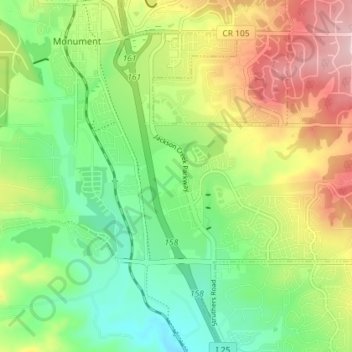
Name: Monument topographic map, elevation, terrain.
Location: Monument, El Paso County, Colorado, United States (39.04222 -104.88119 39.09819 -104.84331)
Average elevation: 6,998 ft
Minimum elevation: 6,677 ft
Maximum elevation: 7,490 ft
Colorado trails, hiking, mountain biking, running and outdoor activities