
Thank you for supporting this site ❤️
Make a donation
Make a donation
Gear up for your next adventure:
As an Amazon Associate, this site earns from qualifying purchases at no extra cost to you.
Sidodadi topographic map
Click on the map to display elevation.
Thank you for supporting this site ❤️
Make a donation
Make a donation
Gear up for your next adventure:
As an Amazon Associate, this site earns from qualifying purchases at no extra cost to you.
About this map
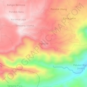
Name: Sidodadi topographic map, elevation, terrain.
Location: Sidodadi, Bandar, Bener Meriah, Aceh, Sumatra, Indonesia (4.69371 96.91387 4.73371 96.95387)
Average elevation: 3,845 ft
Minimum elevation: 2,579 ft
Maximum elevation: 4,639 ft
Thank you for supporting this site ❤️
Make a donation
Make a donation
Gear up for your next adventure:
As an Amazon Associate, this site earns from qualifying purchases at no extra cost to you.
Other topographic maps
Click on a map to view its topography, its elevation and its terrain.