
Thank you for supporting this site ❤️
Make a donation
Make a donation
Gear up for your next adventure:
As an Amazon Associate, this site earns from qualifying purchases at no extra cost to you.
Zeuthen topographic map
Click on the map to display elevation.
Thank you for supporting this site ❤️
Make a donation
Make a donation
Gear up for your next adventure:
As an Amazon Associate, this site earns from qualifying purchases at no extra cost to you.
About this map
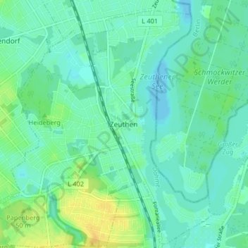
Name: Zeuthen topographic map, elevation, terrain.
Location: Zeuthen, Dahme-Spreewald, Brandenburg, 15738, Deutschland (52.33083 13.60939 52.37083 13.64939)
Average elevation: 128 ft
Minimum elevation: 105 ft
Maximum elevation: 180 ft
Thank you for supporting this site ❤️
Make a donation
Make a donation
Gear up for your next adventure:
As an Amazon Associate, this site earns from qualifying purchases at no extra cost to you.