Geolocate

Rahuri topographic map

Click on the map to display elevation.

Rahuri

Rahuri is located at 19°23′N 74°39′E / 19.38°N 74.65°E / 19.38; 74.65. It has an average elevation of 511 metres (1,676 feet).

Wikipedia (CC-BY-SA 3.0)

About this map

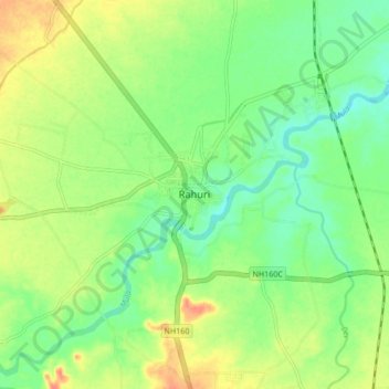
Name: Rahuri topographic map, elevation, terrain.

Location: Rahuri, Ahmednagar District, Maharashtra, 413705, India (19.34918 74.60991 19.42918 74.68991)

Average elevation: 1,696 ft

Minimum elevation: 1,631 ft

Maximum elevation: 1,788 ft

Gear up for your next adventure:

🏥Hiking First Aid Kits - Comprehensive medical kits for remote trail injuries
🎒Trekking Poles - Sturdy poles for balance and stability on rough terrain
🌡️Handheld Weather Meters - Measure wind, temp, and pressure for safe mountain travel
🏕️Tent Footprint - Protect your tent base from wear
🎒Outdoor Daypacks - Lightweight backpacks designed for carrying maps and essential gear

As an Amazon Associate, this site earns from qualifying purchases at no extra cost to you.