
Monmouth topographic map
Click on the map to display elevation.
About this map
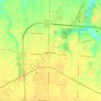
Name: Monmouth topographic map, elevation, terrain.
Location: Monmouth, Warren County, Illinois, 61462, United States (40.89176 -90.66749 40.93574 -90.60996)
Average elevation: 761 ft
Minimum elevation: 689 ft
Maximum elevation: 791 ft
Warren County trails, hiking, mountain biking, running and outdoor activities
Other topographic maps
Click on a map to view its topography, its elevation and its terrain.