
Thank you for supporting this site ❤️
Make a donation
Make a donation
Gear up for your next adventure:
As an Amazon Associate, this site earns from qualifying purchases at no extra cost to you.
Jupille-sur-Meuse topographic map
Click on the map to display elevation.
Thank you for supporting this site ❤️
Make a donation
Make a donation
Gear up for your next adventure:
As an Amazon Associate, this site earns from qualifying purchases at no extra cost to you.
About this map
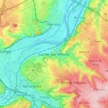
Name: Jupille-sur-Meuse topographic map, elevation, terrain.
Location: Jupille-sur-Meuse, Liège, Wallonia, 4000, Belgium (50.60319 5.59013 50.68319 5.67013)
Average elevation: 436 ft
Minimum elevation: 174 ft
Maximum elevation: 886 ft
Thank you for supporting this site ❤️
Make a donation
Make a donation
Gear up for your next adventure:
As an Amazon Associate, this site earns from qualifying purchases at no extra cost to you.