
Banoak topographic map
Click on the map to display elevation.
About this map
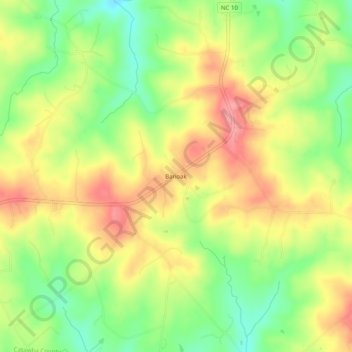
Name: Banoak topographic map, elevation, terrain.
Location: Banoak, Catawba County, North Carolina, 28168, United States (35.56624 -81.42898 35.60624 -81.38898)
Average elevation: 1,102 ft
Minimum elevation: 938 ft
Maximum elevation: 1,260 ft
Catawba County trails, hiking, mountain biking, running and outdoor activities