Geolocate

Craig topographic map

Click on the map to display elevation.

About this map

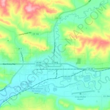
Name: Craig topographic map, elevation, terrain.

Location: Craig, Moffat County, Colorado, 81625, United States (40.50221 -107.60119 40.53800 -107.50454)

Average elevation: 6,309 ft

Minimum elevation: 6,145 ft

Maximum elevation: 6,703 ft

Moffat County trails, hiking, mountain biking, running and outdoor activities

Other topographic maps

Click on a map to view its topography, its elevation and its terrain.

Diamond Peak

United States > Colorado > Moffat County

Average elevation: 8,947 ft

Schoonover Buttes

United States > Colorado > Moffat County

Average elevation: 6,240 ft

Gear up for your next adventure:

Backpacking Tents - Weight-optimized shelters for multi-day topographic surveys
📖Nature Tracking Books - Learn to track wildlife and terrain
🧭Orienteering Set - Complete compass and map reading kit
🩳Quick‑Dry Hiking Shorts - Comfortable and quick‑dry shorts for summer hiking
🥾Hiking Shoes - Durable and comfortable shoes for trail hiking

As an Amazon Associate, this site earns from qualifying purchases at no extra cost to you.