
Thank you for supporting this site ❤️
Make a donation
Make a donation
Gear up for your next adventure:
As an Amazon Associate, this site earns from qualifying purchases at no extra cost to you.
Al Hijr topographic map
Click on the map to display elevation.
Thank you for supporting this site ❤️
Make a donation
Make a donation
Gear up for your next adventure:
As an Amazon Associate, this site earns from qualifying purchases at no extra cost to you.
About this map
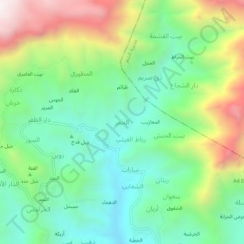
Name: Al Hijr topographic map, elevation, terrain.
Location: Al Hijr, Ba'dan District, Ibb Governorate, Yemen (14.00292 44.28609 14.04292 44.32609)
Average elevation: 8,094 ft
Minimum elevation: 6,913 ft
Maximum elevation: 10,331 ft
Thank you for supporting this site ❤️
Make a donation
Make a donation
Gear up for your next adventure:
As an Amazon Associate, this site earns from qualifying purchases at no extra cost to you.